The University of Texas at Dallas
close menu

School Mourns Loss of Geosciences Professor Carlos Aiken

Dr. Carlos Aiken
Dr. Carlos Aiken, professor of geosciences, passed away last month after a career that spanned 40 years.

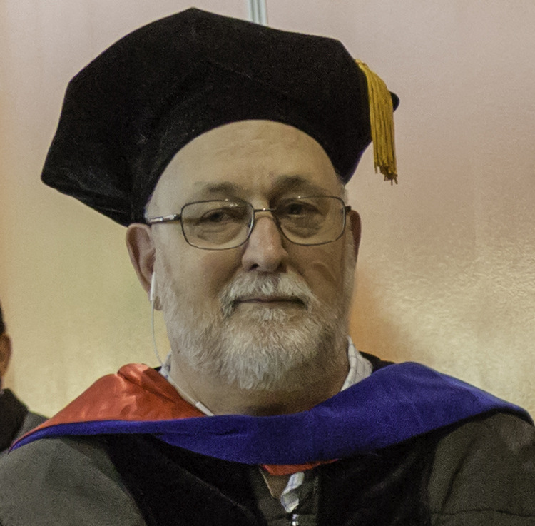
Professor Emeritus Carlos Lynn Virgil Aiken passed away peacefully on June 18, 2021 at Medical City Plano. Carlos was born on June 6, 1941 in Webster, South Dakota, to Randolfo Cossio Aiken and Elvira Esturo. He served in the National Guard in 1957. Carlos received his bachelor’s of science from the University of Washington in 1965 and married Kathy Paulsen, the love of his life, in 1966. Their marriage lasted almost 55 years.

They stayed in Seattle, and he received his master’s in 1970 from the University of Washington. Then they moved to Arizona where he received his PhD from the University of Arizona in 1976. Carlos came to Texas to join the Texas Christian University faculty, where he served for two years before Anton Hales recruited him to join the UT Dallas Department of Geosciences. He joined as an assistant professor in 1978, gained tenure easily and rose through the ranks to become professor.

He started out specializing in what geoscientists then-called “potential fields,” measuring Earth’s gravity and magnetic fields in different places around the US and Mexico, and using these gravity and magnetic maps to identify important features in the Earth’s crust for oil and gas exploration. He was one of the founding faculty of the Summer of Applied Geophysical Experience (SAGE) field course in 1983. In the 1990s he became increasingly interested in using the new satellite global positioning systems (GPS) and this led quickly to his interest in Geographic Information Systems (GIS). Not long after, he started digital outcrop mapping or “cyber-geology” and founded the UTD Cybermapping Lab (where you can learn more about cybermapping and download scans). Carlos originated the concept of photorealistic outcrop models from LiDAR and photos. He and Xueming Xu have patent # 6,590,640 dated July 8, 2003, “Method and apparatus for mapping three-dimensional features.” An October 2018 workshop in France to discuss the establishment of a worldwide archive for such models acknowledged that Carlos played the leading role in establishing this 21st century technology. Carlos continued his teaching and research in this field until he retired in 2018.

Carlos Aiken’s M.S. and PhD Students

M.S. Thesis (18):                                                                           

Watch some of his field cybermapping activities. Dr. Aiken’s research took him and his students all over the world, including Ecuador, Greenland, Mexico, Alaska, England, Ireland, Spain, and Saudi Arabia. His joy was most evident when working with students in the field and in the lab.
  • R. Felch, M.S. (T.C.U.), 1979, A three dimensional gravity model of basin structure, Yucca Flat, Nevada.
  • S. K. Western, M.S. (T.C.U.), 1980, The interdependence of gravity anomalies with topography in Chihuahua, Mexico, southern New Mexico and west Texas.
  • W. D. Kennedy, M.S., 1982, Geophysical Studies of the Southern Albuquerque Basin of the Rio Grande Rift, New Mexico.
  • K. L. Mickus, B.S., M.S., 1985, A Controlled Source Audiomagnetotelluric Survey as Part of an Integrated Geophysical Study of the Richmond Triassic Basin, Virginia. 
  • S. H. Schaps, 1985, A Gravity/Seismic Interpretation of Cretaceous Features Within the Central Portions of the National Petroleum Reserve in Alaska.
  • C. Yang, B.S., 1986, The Magnetoelectric Phenomenon Reviewed and Evaluated as an Exploration Tool to Detect Hydrocarbon Accumulation.
  • S. Lee, M.S., 1986, Phase Field Imaging of 2-D Resistivity Distributions from Electromagnetic Data.
  • B. A. Lasley, B.S., 1987, A Detailed Study of Thrust Fault Zones and the Structural Relationship of the Penitentiary and Carbon Thrust Faults, Krebs Quadrangle, Oklahoma.
  • R. W. Schellhorn, B.S., 1987, Bouguer Gravity Anomalies and Crustal Structure of Northern Mexico.
  • B. C. S. Ragland, B.S., M.S., 1988, Gravity Investigation of a Portion of the Ouachita Central Zone, Southeastern Oklahoma and Western Arkansas.
  • R. L. Hunt, B.S., 1992, A Gravity/Magnetic Investigation of the Crustal Structure of South Texas/Northeastern Mexico: Interferences on the Mesozoic Tectonics.
  • T. C. Stallings, B.S., 1994, Using Geographic Information System for a Geophysical and Geological Interpretation of Northern Mexico.
  • Hunter-Huston, Holly, M.S., 1996, An integrated 3-D gravity and seismic study of the Ouachita Frontal Thrust Belt, Pittsburg and Latimer Counties, Oklahoma.
  • G. D. Lyman, B.S., 1997, Terrain Mapping by Reflectorless Laser Rangefinding Systems for Inner Zone Gravity Terrain Corrections.
  • M. R. Ugalde, M.S., 2002, Development of an Innovative Stream Bank Erosion Survey Method and Application at Wilson Cree-Heard Museum Nature Conservatory-McKinney-Collin County, East Trinity River Basin, Texas.
  • A.H. Covault, B.S., 2006, Structural Architecture and Deformation of the Salina Creek Tunnel Normal Fault Zone, Central Utah, USA.
  • L. S. White, B.S.E.E., M.S.E.E., 2010, The Development of Computer Algorithms for the Construction and Analysis of Photorealistic 3D Virtual Models of Geological Outcrops.
  • R. J. Aguilar, B.S., M.S. 2017, The determination of the fracture architecture and deformational behavior of the Fish Lake Valley Fault Zone, California: a digital approach using photorealistic surface mapping with Lidar.

PhD Dissertations (13):                                                                                   

Carlos continued his teaching and research in this field until he retired in 2018.
  • R. Felch, M.S., (T.C.U.), 1979, A Three-Dimensional Gravity Model of Basin Structure, Yucca Flat, Nevada
  • S. K. Western, M.S., (T.C.U.), 1980, The Interdependence of Gravity Anomalies with Topography in Chihuahua, Mexico, Southern New Mexico and West Texas.
  • M. Hong, M.S., 1982, The Inversion of Magnetic and Gravity Anomalies and the Depth to Curie Isotherm.
  • S. Lai, 1984, Generalized Linear Inversion of 2.5-Dimensional Gravity and Magnetic Anomalies.
  • M. Balde, B.S., D.E.A., 1995, Vertical Control by GPS Satellite Surveying Rapid Methods and High-Resolution Local GEOID Computation. Applications to High Accuracy Mapping and Geophysical Data Acquisition. 
  • X. Xu, M.S., 2000, Three-Dimensional Virtual Geology: Photorealistic Outcrops, and Their Acquisition, Visualization and Analysis. 
  • J. B. Thurmond, B.S., 2006, Applications of Three-Dimensional Digital Mapping in Sedimentology: Collection, Visualization, and Interpretation.
  • M. I. Olariu, B.S., 2007, Development and Testing of Methods for Analysing High Resolution 3-D Digital Outcrop Geology: Big Rock Quarry, Arkansas.
  • M. S. Alfarhan, B.S., M.S., 2010, Geosciences Information System (GEOIS): A Geospatial Paradigm for Real and Virtual 3D Worlds.
  • M. Wang, B.S., M.S., 2013, Developments in Photorealistic Mapping, Modeling and Analyses of Terrestrial Scanning of Geological Outcrops.
  • W. D. Edwards, B.S., M.S., 2016, River Channel Monitoring of the Red River of the Texas and Oklahoma State Boundary, U.S.A., Using Remote Sensing Techniques and the Legal Implications on Riparian Boundaries.
  • M. S., Alhumimidi, B.S., 2017, Hyperspectral Imagery and Terrestrial Laser Scanning Integrated with Surface and Subsurface Data Sets for the Geologic Analysis of the Permian Carbonates of the Khuff Formation in Saudi Arabia.
  • T. L. Urbanski, 2018, Virtual Geologic Environments: Interfaces to incorporate visualization and analyses of 3-D models in Geoscience Education and Research

Donate to NSM

Help us leave the planet a better place for future generations. Your support for the School of Natural Sciences and Mathematics funds scientific discoveries with real-world applications, student and faculty recruitment, and academic scholarships.